
I’m starting to use Google Earth more and more these days for different projects and presentations. So in addition to previous posts related to Google Earth, I was looking around for some resources today and happened onto the Pennsylvania Civil War Trails website. One of the cool things I noticed is that they now have a KMZ file to add to your Google Earth specifically related to Pa’s trails.
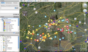
Here is a photo from Google Earth with the file loaded. Check out all of the locations to explore!
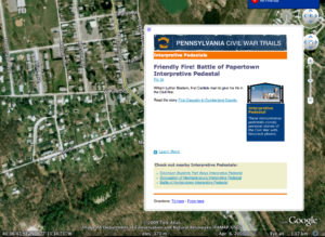
Here is a close up detail of one of the items:
Last but not least, is the Civil War Trails website also includes several photos of the Gettysburg battlefield, museums, towns and cemeteries in GIGAPAN format!!!
Here are some links:
Little Round Top from Devils Den
So many integration ideas come to mind, I don’t know where to start. One for starters would be to have your kids explore the photos or the Google Earth locations and look for clues and write a narrative about what they are looking at.
So much to explore and so little time…let me know what you find.


0 Comments